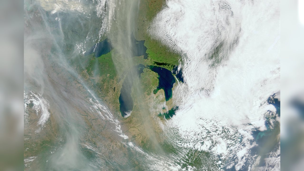
An ocean-monitoring satellite designed primarily to study sea surface temperatures and marine ecosystems has captured a dramatic view of wildfire smoke spreading across vast distances, offering a new perspective on how such events affect the atmosphere and climate. The image, released as part of a space photo series, shows thick plumes of smoke from active wildfires being carried by wind currents over hundreds of miles, highlighting the interconnectedness of Earth's systems.
The satellite, part of a fleet operated by the National Oceanic and Atmospheric Administration (NOAA) and NASA, uses advanced sensors to detect thermal anomalies and aerosol particles. While its main mission involves observing ocean color and temperature to monitor phenomena like El Niño and coral bleaching, the same instruments can pick up the signature of smoke from large wildfires. This dual-use capability allows scientists to track not only the fires themselves but also the transport of smoke and its potential impacts on air quality and weather patterns.
Wildfire smoke contains fine particulate matter and gases that can harm human health and influence climate by absorbing or scattering sunlight. When smoke rises high into the atmosphere, it can travel thousands of miles, affecting regions far from the original blaze. The satellite imagery helps researchers model these trajectories and predict where smoke might descend, providing valuable data for public health warnings and environmental monitoring.
The specific image featured was taken during a period of intense wildfire activity in North America, though the satellite's global coverage means it can monitor fires on multiple continents simultaneously. Such observations are increasingly important as climate change contributes to longer and more severe wildfire seasons in many parts of the world. Warmer temperatures and drier conditions create more fuel for fires, leading to larger burns and more smoke production.
Beyond immediate fire monitoring, the satellite data contributes to long-term studies of how wildfires affect ocean ecosystems. Smoke deposits nutrients like iron and nitrogen into the ocean when it settles, potentially stimulating phytoplankton blooms. These microscopic plants form the base of the marine food web and play a role in carbon cycling. Understanding these connections helps scientists assess the full environmental footprint of wildfires.
The satellite's ability to detect smoke also aids in validating computer models used for climate projections. By comparing observed smoke patterns with model simulations, researchers can refine their understanding of atmospheric transport and the radiative effects of aerosols. This improves the accuracy of forecasts for both weather and climate.
NOAA and NASA have a history of repurposing satellite data for unexpected applications. For example, ocean-monitoring satellites have been used to track volcanic ash clouds, dust storms, and even the movement of algae blooms. The wildfire smoke detection is another example of how investments in Earth observation yield benefits across multiple scientific disciplines.
As wildfire seasons intensify, the role of space-based monitoring becomes more critical. Satellites provide a consistent, wide-angle view that ground-based sensors cannot match, enabling rapid detection of new fires and continuous tracking of smoke plumes. This information supports emergency response efforts and helps mitigate the health and economic impacts of wildfires.
The image serves as a reminder of the power of Earth observation technology and the value of maintaining a robust fleet of environmental satellites. It also underscores the need for continued investment in climate monitoring infrastructure to address the growing challenges posed by a warming planet.
205