NASA and IBM researchers have unveiled a powerful new artificial intelligence model built to map the surface of the Moon in more detail than any previous effort, a development that could sharpen the planning of future lunar missions and deepen scientific understanding of the lunar terrain.
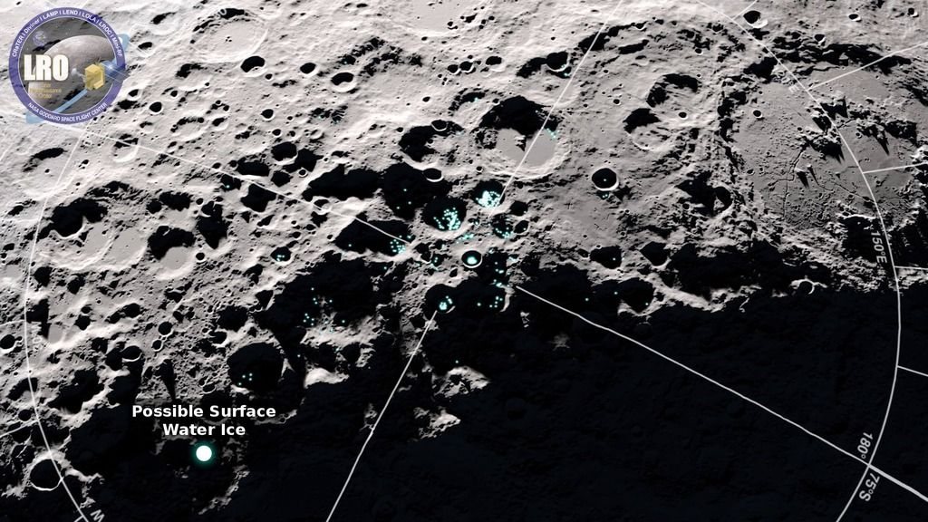
The model is described as the first of its kind for this purpose, applying advanced machine learning to the challenge of charting the Moon's heavily cratered and uneven surface. According to the scientists behind the work, the system is capable of resolving features at a level of detail that conventional mapping methods have struggled to achieve, particularly in regions where shadows, steep slopes, and overlapping craters complicate automated analysis.
Mapping the Moon with high precision matters for more than cartography. Landing sites, rover routes, resource surveys, and geological studies all depend on accurate terrain data. As NASA and its international partners prepare for renewed human and robotic activity on the lunar surface, the demand for detailed, reliable maps has grown sharply. The new AI model is intended to help meet that demand by processing large volumes of lunar imagery and elevation data more efficiently than manual or traditional computational approaches.
The collaboration pairs NASA's deep experience in lunar observation and planetary science with IBM's expertise in artificial intelligence and large-scale computing. That combination reflects a broader trend in space science, where machine learning is increasingly used to extract meaning from the enormous datasets produced by orbiting spacecraft, telescopes, and surface instruments. The Moon has been photographed and scanned for decades, but turning those archives into consistent, high-resolution maps remains a substantial technical challenge.
Scientists say the model could help identify subtle surface features that might otherwise be missed, including small craters, ridges, and deposits that carry clues about the Moon's history and its potential resources. Such details are relevant to both pure research and mission planning, where even minor terrain hazards can affect where a spacecraft lands or how a rover navigates.
The announcement adds to a period of intense international interest in lunar exploration. Several national space agencies and private companies are pursuing missions to the Moon, with goals ranging from scientific study to resource assessment and eventual long-term presence. Reliable maps underpin nearly all of those ambitions, from choosing safe landing zones to locating areas of scientific interest.
While the scientists have not yet released a complete map produced by the model, the work signals a step forward in how lunar data will be analyzed in the coming years. If the approach performs as expected, it could become a standard tool for planetary scientists and mission planners alike, offering a more detailed view of the Moon than has previously been available.
The project also highlights the growing role of artificial intelligence in space exploration, where vast datasets and complex terrain make automated analysis increasingly valuable. For NASA and IBM, the lunar mapping effort represents both a technical achievement and a foundation for future work, as the Moon once again becomes a central destination for human and robotic exploration.
105