
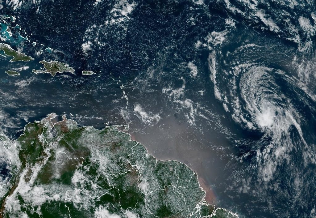
Tropical Storm Dolly has formed in the Atlantic Ocean, becoming the fourth named storm of the 2026 hurricane season. The system, previously designated as Invest 96L, strengthened into a tropical storm as it moved across the open waters, according to forecasters monitoring its development.
The storm's formation marks an active start to the season, with Dolly joining the ranks of other named systems that have already developed this year. Meteorologists are closely watching the storm's trajectory, though its position over the open Atlantic suggests it may remain away from major landmasses in the near term.
Forecasters noted that Dolly's development was not entirely unexpected, as the system had shown signs of organization in the days leading up to its designation. The storm is being tracked using satellite imagery and data from hurricane hunter aircraft, which provide critical information about its intensity and projected path.
The 2026 Atlantic hurricane season has already produced several named storms, and Dolly's arrival continues a pattern of above-average activity that forecasters had predicted earlier in the year. Climate conditions in the Atlantic, including warm sea surface temperatures and favorable wind patterns, have contributed to the conditions that allow tropical systems to develop and intensify.
While Dolly is currently over open water, forecasters emphasize that tropical storm paths can shift, and residents in coastal areas are advised to stay informed about the storm's progress. The National Hurricane Center and other meteorological agencies are providing regular updates on Dolly's position, intensity, and forecast track.
The formation of Dolly comes as communities across the Atlantic basin remain vigilant during what is typically the peak period for hurricane activity. Late August through September historically marks the most active stretch of the hurricane season, when conditions are most conducive for tropical cyclone formation.
Forecasters are also monitoring other areas of the Atlantic for potential development, as the conditions that spawned Dolly could give rise to additional systems in the coming days. The ability to detect and track these systems early is a key part of preparedness efforts, giving coastal communities time to make necessary arrangements.
As Dolly continues its journey across the Atlantic, meteorologists will be watching for signs of strengthening or weakening, as well as any changes in its projected path. The storm's development serves as a reminder of the importance of hurricane preparedness, even for systems that currently pose no immediate threat to land.
101